Dan's Hiking Pages: Hikes in the San Gabriels and Beyond
|
Dan's Hiking Pages: Hikes in the San Gabriels and Beyond |
||
|
|
|
|
 Fish Fire – Began 6-20-16
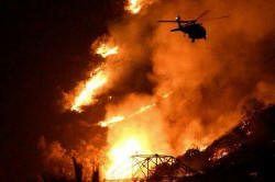
On Monday morning, June 20, 2016 the Fish Fire started near the mouth of Fish Canyon and quickly burned its way up Van Tassel Ridge, and within a day had consumed several thousand acres of foothills and canyons above Duarte and Azusa. Most of Fish Canyon surrounding Fish Canyon Trail to the waterfall and beyond is within the burn area. Beautiful Fish Canyon suffered widespread and significant damage. As of Friday, July 1, the Fish Fire had consumed 4,253 acres and was 96 percent contained. The fire was essentially out and they were just mopping up hot spots. The cause of the fire was never determined. Due to fire damage, the Forest Service issued a closure order for most of the area of Van Tassel and Fish canyons, including Van Tassel Fire Road to Mt. Bliss. The closure was for one year from September 8, 2016 through September 7, 2017. After the closure order expired, the trail access route for Fish Canyon Trail through the Vulcan Materials quarry remained closed due to significant damage to the trail and surrounding slopes. As of February 2020, the trail is still closed with no reopening date projected. Reopening the trail is complicated because there are at least four jurisdictions involved: The trailhead is in the City of Azusa, the trail beyond the Vulcan quarry is on land owned by the California State Lands Commission within the City of Duarte and the Angeles National Forest.
|
 Colby Fire - Began 1-16-14
The Colby Fire began on Thursday, January 16, 2014 about 6 a.m. in the vicinity of Glendora Mountain Road and Colby Trail. The fire quickly spread west consuming the mountainsides above Glendora and Azusa. By the end of first day the inferno was only 30% contained and had destroyed 1,709 acres, five homes, and forced the evacuation of thousands from their homes. As of about 4:30 p.m. on Wednesday, January 22, (day 7), the fire was 98% contained with 1,952 acres consumed. According to the San Gabriel Valley Tribune, U.S. Forest Service officials announced that the Colby Fire was declared 100 percent contained on Friday, January 31. The fire significantly damaged Garcia Trail in Azusa forcing an indefinate closure. The fire also forced the temporary closure of Colby Trail in Glendora. |
 Williams Fire 2012 - Began 9-2-12
Began on Labor Day Sunday, September 2 at about 2:15 p.m., ten years to the month that the Williams Fire 2002 began. In fact, it was 10 years to nearly the exact hour as the Curve Fire stated. The Williams Fire 2012 began in San Gabriel Canyon on East Fork Road about half way between Williams Camp and Burro Canyon Shooting Park to the west, about 3 1/2 miles east of Hwy 39. Officials determined that the fire was caused by a parked car. The hot undercarriage ignited grass, which set the car ablaze and ignited the hillside. The fire consumed 4,192 acres of Angeles National Forest and took $9 million and 10 days to contain. As with the 2009 Station Fire, the Forest Service again is suspect of responding too slowly with the aerial attack, thus allowing the fire to blaze out of control when it may have been possible to contain it early on. I had the unique and fortuitous experience of spotting the fire minutes after it started while I was at the ruins of the historic South Hawkins Fire Lookout, about 5 miles north. Read more at the links below. [9-26-12]
|
 Station Fire - Began 8-26-09
The Station Fire began as a result of arson on Wednesday, August 26, 2009, at about 3:30 p.m., near the USFS Ranger Station on the Angeles Crest Highway above La Canada, and burned 160,577 acres, or nearly 251 square miles. It killed two firefighters, Arnaldo Quinones and Tedmund Hall, destroyed 89 homes and 26 commercial buildings . It also destroyed the historic Vetter Mountain Fire Lookout. The fire cost more than $95 million to fight was not contanined until Friday, October 16. It was the tenth largest fire in the modern history of California and the largest in the modern history of Los Angeles County. It consumed one third of the Angeles National Forest resulted in the closure of 294,317 acres of our beloved forest. Gradually over the years, the Forest Service opened portions of the forest for public use. As of May 28, 2013, were 46,194 acres of the forest still closed. On May 24, 2014 the last of the Station Fire closure orders expired and the public is now allowed to enter nearly all of the remaining 46,000 acres in the Angeles National Forest aside from a few road closures. The Forest Service has been widely criticized for what appeared to a mishandling of the early fire attack and has been under congressional investigation. The L.A. Times has reported that the Forest Service misjudged the threat posed by the fire after the first day, scaled back its attack and then failed to fill its own commander's order for a heavy air assault at 7 the next morning, when the blaze was still small. By the time the bigger aircraft arrived two hours later, the fire was raging out of control. A year after the fire, Jody Noiron, supervisor of the Angeles National Forest and a target of some criticism over handling the Station Fire, was reassigned to the same job in the San Bernardino National Forest (see L.A. Times article, October 9, 2010).
|
 Morris Fire (aka Morris Dam Fire) - Began 8-25-09
In the midst of a triple-digit heat wave, the Morris Fire started on Tuesday, August 25, 2009 at about 2:27 p.m. in the Angeles National Forest. The fire began alongside of Hwy 39 in San Gabriel Canyon near Morris Dam and burned west and east, consuming a total of 2,168 acres. Burn map with labels / Burn map source from Google maps Other than burning to the peaks of Silver Mountain and Glendora Mountain and trails that lead to them, the Morris Fire did not affect any mayor hiking trails. The Morris Fire did not get much attention because it was eclipsed by the Station Fire, which began the next day and went on to consume 160,577 acres, one third of the Angeles National Forest. |
 The "Curve-Williams Complex" September 2002
 Between the Curve Fire, which started on September 1, and the Williams Fire, which started on September 22, more than 58,097 acres of our beautiful Angeles National Forest has been destroyed. Forestry officials are now calling the aftermath the "Curve-Williams Complex" since the two locations are adjoined. The heartbreak for me is that these two fires devastated the area of the San Gabriel Mountains that our family uses the most for recreation. The burn area starts just minutes up Highway 39 from our home in Azusa. One of the tragic ironies is that just the weekend before, I had renewed our annual adventure pass in preparation for a planned hike up to South Hawkins Fire Lookout over the Labor Day weekend. Not only did the fire prevent our hike, it also destroyed the fire lookout. And with the Angeles National Forest now closed (view archive page capture), it's uncertain when we'll get to use our adventure pass again. But beyond the inconvenience of curtailing my hiking activities, the real threat now is massive mudslides and devastating soil erosion as the rainy months approach. If you are a person of faith, please pray for mild rains, spread evenly throughout this coming winter. [10-9-02] |
 Williams Fire - Began 9-22-02
As of Tuesday evening, October 1, nine days after starting, the fire is officially contained. They say it will take weeks more to mop up the hot spots. 37,240 areas of our wonderful national forest destroyed. Thankfully, the magnificent high country to the east of Mt. Baldy Road was spared. [10-9-02] See Curve-Williams Complex above for more details. - Fire Map (9-24-02) |
 Curve Fire - Began 9-1-02
The Curve Fire consumed 20,857 acres, inlcuding much of the Crystal Lake Basin, parts of Sheep Mountain Wilderness, and destroyed the historic South Hawkins Fire Lookout. It's expected to take weeks more to mop up the hot spots. [Updated 10-9-02] See Curve-Williams Complex above for more details.
|
 SmokeyBear.com SimpsonCity Home
Dan's Hiking Pages: Hikes in the San Gabriels and Beyond! |