| |

 |
| |
|
| |
 |
| |
 |
| |
 |
| |
 |
| |
 |
| |
 |
| |
 |
| |
 |
| |
 |
| |
Dan's Hiking Pages: Hikes in the San Gabriels and Beyond |
|
|
Stoddard Peak (4624')
via Barrett-Stoddard Road
San Antonio Canyon / Angeles National Forest / Southern California
 Hike Report: December 28, 2005 Stoddard Peak Hike Description Hike Report: December 28, 2005 Stoddard Peak Hike Description
|
Trail Stats
|
|
Mileage
|
6.0
|
|
Trailhead
|
3790'
|
|
Stoddard Peak
|
4624'
|
|
Total gain/loss
|
1100'
|
|
Gain/loss per mi.
|
366 '
|
I had been eye-balling this hike for several years now. It is written up in Jerry Schad's book and looked like a nice little hike. And every time I drive up into San Antonio Canyon I've wondered about the hiking possibilities as I looked up and saw the array of little peaks on the east side of the canyon.
So as the year was coming to an end and I had some time off, I wanted to get one more hike in before the calendar turns. Rain was forecast for later in the week and on the weekend, so it looked like I had a window of opportunity on Wednesday, December 28. I had a few possible hikes in mind, but Stoddard Peak emerged as the top pick. I wanted to do something I had not yet done, and I wanted to climb to a peak. I actually wanted to click off another hike from Robinson's Trail of the Angeles, but that would require a drive up the Angeles Crest Hwy, and I did not want to be in the high country with bad weather threatening. So Stoddard it was.
My alarm goes off at 6:00 AM. I leave my house in Azusa at about 7:15, and 21 miles later arrive at the trailhead. The weather is brisk, so I put on my flannel shirt.
7:55 AM - Begin hike. As always, I have a little sense of excitement as venture off on a trail I've never hiked.
8:00 - Cross San Antonio creek on bridge. Lots of water, quite picturesque.
8:03 - Take picture back northwest toward the creek and parking area.
8:06 - Round bend into Barrett Canyon. Nice view east into the woodsy haunt nestled snuggly in the lower reaches of the canyon.
8:12 - Cross creek flowing across road (North Fork) Had to tip toe along some rocks on the left road edge to avoid the water. Some cute cabins are on the right. The road cuts back to the south and continues to climb under a canopy of live oak. More cabins. A lady cutting firewood waves to me. Cross a little footbridge to avoid more water streaming across the road (Barrett Caynon creek). Some yelping dogs greet me, as mentioned by Schad. Pick up a stick just in case, but thankful the dogs are chained.
8:16 - Locked vehicle gate (at 0.8 mile according to Schad). Walk past the gate. The forest is thick and acorns blanket the road.
8:26 / 8:41 - Emerge from the forest to some nice views. Abundant evidence of a wildfire that had devastated up to this point from the west and south — no doubt the Williams Fire of Fall 2002. Take some pics. Can see the car parked at the trailhead. Shed the flannel shirt. Look at the map. 15 minutes pass quickly here.
The roads curves around southeast as it approaches Cascade Canyon. The grade is gentle and I'm able to walk fast. Everything is wide open. Would be hot in the summer. The road starts to descend slightly as it bends around east into the canyon. The scenery up the canyon is stunning.
8:47 - Cross Cascade Canyon creek. Pretty. As the trail emerges from the canyon I take note of the thick alluvium (sediment deposit) exposed by the road cut. The road curves back around and passes through a thin forest of burned pines. The topography is relatively flat.
9:00 - Round the bend to get the first view of Stoddard Saddle and the first false summit. Stoddard Peak is hidden behind it. I get the first view of the sun as it emerges above the ridge, muted by the hazy clouds. Feels like winter. The air is still cool and much of the vegetation dead. The yellow grass adds a nice dash of color, as do the red berries of the toyon. Evidence of fire still abounds.
9:10 / 9:19 - Stoddard Saddle. - A pile of rocks marks the junction for the use path leading west steeply up the slope. Looks pretty brushy so I decide to zip on my pant legs. I view Stoddard Flat, the large gently sloping area on the left. Schad mentions that it is suitable for trial camping, which puzzles me, because I don't know why anyone would want to camp here. I wouldn't. View of Frankish Peak to the south.
I begin to climb the use path. It wasn't as brushy as it first appeared and might be reasonably doable in shorts. The matted grass indicates a fair amount of foot traffic.
9:24 / :26 - First false summit. I take a pic south of the second false summit and of Saddleback (Modjeska Peak—5496' and Santiago Peak—5687') rising above the layer of clouds 35 miles away, floating like a ship.
9: 32 - Second false summit. Neat outcroppings. The real Stoddard Peak comes into view.
9:42 - Stoddard Peak (4624'). What a nice destination! I love the view all around. There's a nice rock to sit and enjoy a lunch and study the map.
Spend some time reading the summit logbook. I notice a Wayne Simpson signed it on 3-5-03 — Wonder if we're related. The last entry was four days earlier on Christmas Eve. It provides a nice description of the view to the north toward Iron Mountain, "Gunsight Pass," and the "Lightening Bolt" vein. Didn't sign his name, but I did notice his boot prints on the path coming up. Fair degree of traffic. The logbook was started on 12-10-97. I thumb through and count 13 parties signed the book in 1998, 18 in 1999, 29 in 2000, and 21 in 2005 (I didn't count the other years). Some parties were a dozen people. Deven sat on this peak exactly three years ago today. Got a kick out of Steve Peterson who writes on 4-20-02, "I'm fifty, I'm fat, and I'm here." I see Roy Randall signed in on 6-14-04. I've enjoyed reading his accounts online and am disappointed that his website is no longer up.
I'm really enjoying the summit. The surrounds are rewarding. I hear cars honking in the tunnels below on Mt. Baldy Road. I don't think most drivers realize how far the sound travels into the wild.
Summits I see that I've climbed include Sunset Peak (5796') and Mt. Baldy (10,064'). Summits that still call to me are Lookout Mt. (6812') and Iron Mt. (8007'). Summits I've not thought too much about before now begin to entice me: Frankish Peak (4198') and Clover Peak (5511'). I'm awed at the huge mass of Ontario Peak (8693') towering over me to the east, completely overshadowing this comparatively diminutive summit. I wonder if the Ontario massif can be climbed from this ridge that looms above me. I'm also drawn to the unnamed summit (4324') just to the south of me. I bet I could hike the ridge to it and keep going all the way to the mouth of Stoddard Canyon. But not today. [After I got home I saw on the online topo map that there is indeed an established route.]
To the north, I use my binoculars to get a closer look at the Bear Canyon Trail as it ascends from Bear Canyon past Bear Flat (out of view) and up Baldy's massive south ridge. I was there five months earlier and remember looking south down canyon at these welts and wondering which one was Stoddard Peak.
The Williams Fire really incinerated much of the area around the peak. I wonder what it was like here before. A lot of the brush, such as manzanita, is growing back from the roots.
It's starting to get really cold and windy with a real threat of rain, so must say goodbye to this fine summit to get to lower ground.
11:15 - Leave summit.
11:22 -Second false summit. Windy! Cold.
11:28 - First false summit. Actually there is nothing false about these summits. They are just as real as Stoddard Peak. It's just that they don't have names, and from certain angles they can be mistaken as Stoddard. Schad points out that the second false summit (the middle one) is actually taller than Stoddard, and I think much more distinctive. But Stoddard has a better view south.
11:34 - Stoddard Saddle - Decide to turn south and explore down the road for a bit.
11:38 - First glimpse of Stoddard Peak, looking back over my shoulder as the road bends east. A few minutes later I happen across two humans - Bob and Nancy. We enjoy a nice visit. They do a lot of hiking in the area and enjoyed my hiking pages. Bob is one of the hosts at the Sierra Club Ski Hut in the upper San Antonio Canyon.
12:05 - Part ways with Bob and Nancy. I continue contouring south.
12:07 - Slide covers the road. Path up and over it.
12:10 - Starts to rain. I struggle to put on my 99-cent poncho in the driving wind. I turn back and head for the trailhead.
12:19 - Slide
12:22 - Place where I visited with Bob and Nancy.
12:29 - Stoddard Saddle. Still windy, cold. Rain is only a sprinkle, but enough to dampen my flannel sleeves extending from the too-short poncho. The poncho plastic whipping around my ears is kind of annoying. But I'm enjoying myself.
12:39 - Round bend (9:00 location).
12:48 - Middle of burnt pine forest. No more rain. Sun peaking out.
12:54 - Cross Cascade Canyon creek. Beautiful scenery up canyon.
1:06 / 1:13 - Bend (8:26 location). Patches of blue sky to the north and east - quite pretty. Shed poncho. Get out trail mix.
1:22 - Creek (not noted on earlier), almost dry. Really having a nice hike.
1:24 - Gate. Couple minutes later almost got past the dogs undetected.
1:30 - Stream (8:12 location). Take pic of cute cabin.
1:37 - Bend (8:06 location). Look back and admire the beauty of the woodsy little community, virtually invisible amongst the trees.
1:42 - Cross San Antonio creek.
1: 47 - Back to car. What a pleasant outing! Even with the sprinkles and cold wind. For the most part the weather was agreeable. I would do this hike again, maybe in the spring when things green up and the flowers begin to bloom.
Drive up the canyon to the Glendora Ridge Road, then up to Cow Canyon Saddle (4527'). Pic of Stoddard Peak. Great views to west. Check out Lookout Mt. trailhead. Looking through the binoculars, the route seems awfully brushy. Head home.
Hike Log
Stoddard Peak
12-28-05
|
|
7:55 AM
|
A: Trailhead (3790')
|
|
8:12
|
B: North Fork creek
|
|
8:16
|
C: Gate
|
|
8:26/8:41
|
D: Round bend past oak forest
|
|
8:47
|
E: Cascade creek
|
|
9:00
|
F: Round bend - view south to saddle
|
|
9:10/9:19
|
G: Stoddard Saddle / Flat
|
|
9:42/11:15
|
H: Stoddard Peak (4624')
|
|
11:34/12:29
|
G: Stoddard Saddle, side trip south
|
|
12:39
|
F: Round bend
|
|
12:54
|
E: Cascade creek
|
|
1:06/1:13
|
D: Round bend
|
|
8:16
|
C: Gate
|
|
1:30
|
B: North Fork creek
|
|
1:47
|
A: Trailhead (3790')
|
|
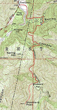
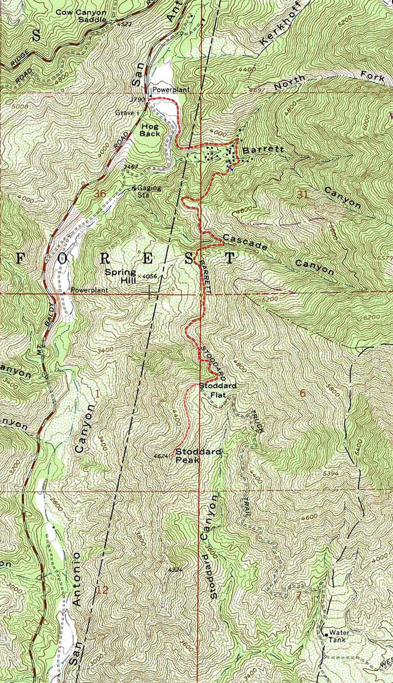
View Full Topo Map (368 K)
|
Related link on Dan's Hiking Pages:
|
|